カナダ最東端探訪
〜セントジョーンズ湾口と歴史的灯台〜
Trecking around Histric Light House in St.Johns
青山貞一 Teiichi Aoyama
7 October 2008
無断転載禁 |
|
※本論考中の写真は一部を除き撮影は(C)青山貞一、Nikon CoolPix S10
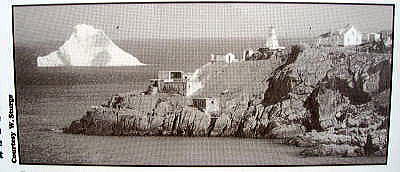
ここでは、NFL、セントジョーンズが大西洋と向かい合う、ほりこみ港(セントジョーンズ湾)の入り口にある灯台(Light
House)とその近くの絶景をごらん頂く。
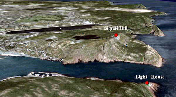
下はグーグルアースで3次元展開したセントジョーンズ湾の入り口である。
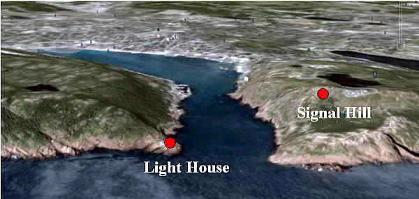
下はグーグルアースで3次元展開したセントジョーンズ湾の大西洋側から見た入り口である。
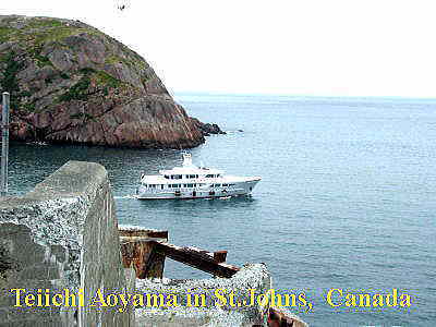
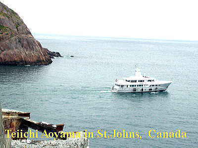
下はシグナルヒルと灯台の間をぬってセントジョーンズ湾を出る船。この海峡は結構深く、大型客船も行き来する。フランスの国旗を付けた客船も出て行った。
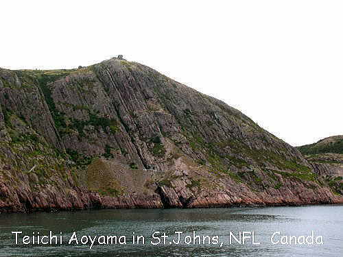
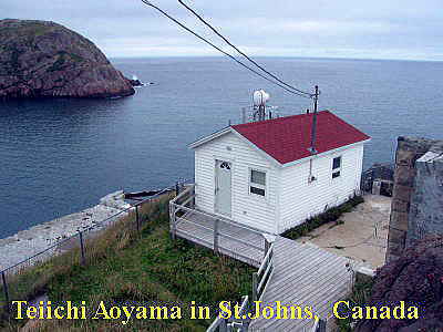
下は灯台の対岸にあるシグナルヒル。頂上に四角く小さく見えるのが通信施設が見える。ここから大西洋を隔ててイギリスと無線通信が行われた。
下はシグナルヒルから見たセントジョーンズ湾の入り口。かすかに灯台が見える。
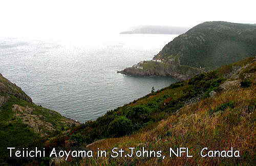
以下はその拡大
下は灯台。
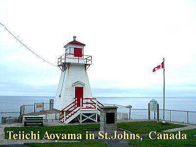
以下は英文だがこの灯台の歴史案内。NFLで最も古い現存する灯台とのこと。灯台は木造建造物である。
Cape Spear National Historic Site of Canada
|
Visit the oldest surviving lighthouse in Newfoundland, dating from
1836. The lighthouse has been restored to its original appearance and
refurnished to reflect a lightkeeper's residence of 1839.
Built in 1835, the
Cape Spear Lighthouse is the oldest existing lighthouse in Newfoundland. The
two-story, wooden structure that served as a marine beacon from 1836 to 1955 is
now a lifestyle museum. It is also an excellent vantage point to view whales and
icebergs.
Following the death of the first Cape Spear lightkeeper, Emmanuel
Warre, James Cantwell and since him, members of the Cantwell family have tended
the light ever since. World War II saw two gun emplacements and underground
passages & barracks added, though most of this was demolished after the war,
though the gun emplacements still exist. Watch for whales, seabirds and
icebergs.
Open May 15 - Oct 15
|
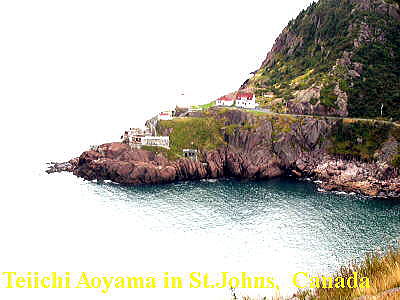
また灯台がある一体は、セントジョーンズのFort Amherst、すなわちアマースト砦と呼ばれている。
Fort Amherst, St. John's
Fort Amherst is a small community within St. John's, Newfoundland and
Labrador. It is located at, on the southern side of "The Narrows",
the entrance to St. John's harbor. Apart from some family dwellings, Fort
Amherst consists of a man-made harbor, a lighthouse and the remains of
gun emplacements built during World War II to defend against German U-boats.
View article on wikipedia.org
Source: Google Earth Wikipedia
|
Fort Amherst Light(アーマスト灯台)のWeb
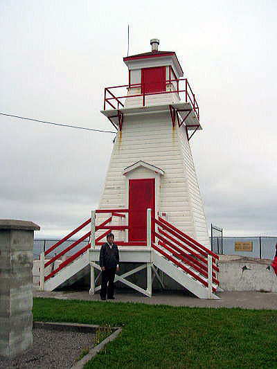
筆者。灯台の下で
Fort Amerst 灯台の概要
| St. John's Newfoundland Canada |
| St. John's Harbour, southeastern
Newfoundland. |
| Fort Amherst Museum, Photo Gallery and
Tearoom |
| The original lighthouse on this site was the first
lighthouse in Newfoundland. |
| 17 |
| White, square pyramidal wooden tower with red
lantern. |
| Yes |
| 1810 |
| 1951 |
| Active aid to navigation. |
| Yes. |
| Fort Amherst can be reached by taking Southside Road
along the southern edge of St. John's Harbour. Map
It! |
| Flashing white every 15 seconds, visible for 13
nautical miles. |
| 131 |
| No |
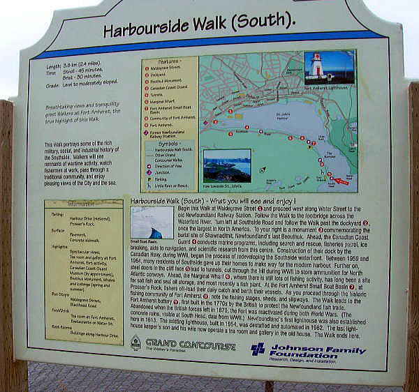
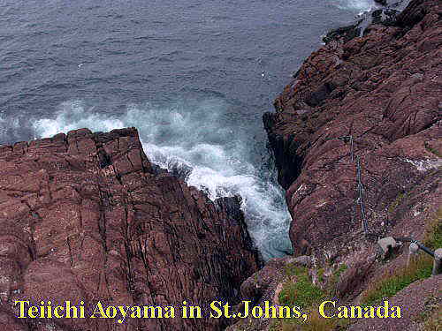
セントジョーンズ湾の周りはハーバーサイド・ウォークというトレッキングトレール(コース)となっている。灯台の位置は地図の下に赤い矢印で示されている。このハーバーサイド・ウォークはセントジョーンズ湾沿いのコースだが、岩場、坂道もありなかなかエキサイティングである。私たちはこのコースの半分を車で周り、車を駐車場に置いて灯台までトレッキングした。
灯台の南側から見た海。水がすごく綺麗なことが分かる。写真を撮るため岩場の前に進む。お尻がムズムズしてくる。
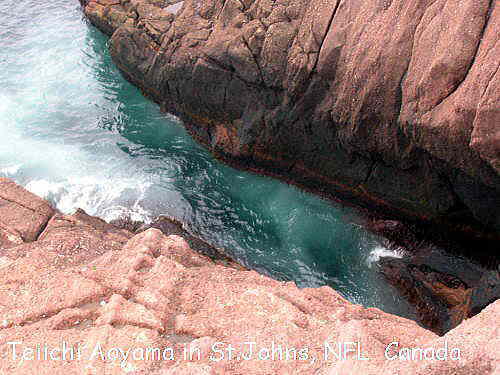
下は上の写真の遠景。ベイ・ブルズがある半島方面を臨む。なかなかの絶景だ。
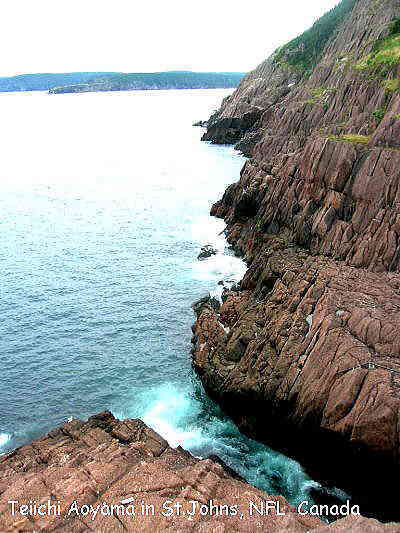
さらに上から撮影してみた。
灯台の歴史。何と右下には灯台近くに流氷が流れてきた写真がある。
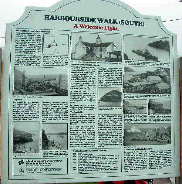
以下はその拡大。なかなかユニークな光景だ。おそらく今後、温暖化化が進めばこのような光景はみられなくなるだおう。
つづく
|