シルクロードの今を征く Now on the Silk Road タリム盆地 展示1 (中国新疆ウイグル自治区) 青山貞一 Teiichi Aoyama 池田こみち Komichi Ikeda 共編 掲載月日:2015年1月22日 更新:2019年4月~6月 更新:2020年4月1日 独立系メディア E-wave Tokyo 無断転載禁 |
| 総合メニュー(西域) ニヤ遺跡 展示1 展示2 タリム盆地 展示1 本稿の解説文は、現地調査や現地入手資料、パンフなどに基づく解説に加え、百度百科中国版から日本への翻訳、Wikipedia 日本語版を使用しています。また写真は現地撮影以外に百度百科、Wikimedlia Commons、トリップアドバイザーさらに地図はグーグルマップ、グーグルストリートビュー、百度地図などを使用しています。その他の引用に際しては、その都度引用名を記しています 次は新疆ウイグル自治区のタリム盆地の展示1です。 ◆タリム盆地 展示1(中国・新疆ウイグル自治区) 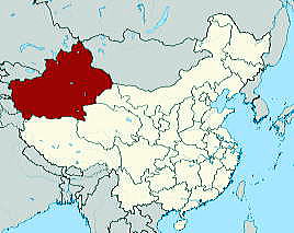 新疆ウイグル自治区 下は新疆ウイグル自治区とアルタイ山脈、天山山脈、崑崙山脈とタリム盆地の関係図です。 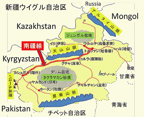 南疆線(なんきょうせん)と天山山脈 (新疆ウイグル自治区) 下図より作成 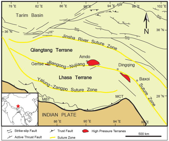 Important high pressure terranes marked along the BNS Source:Wikimedia Commons Chasebill - 投稿者自身による作品, CC 表示-継承 3.0, リンクによる 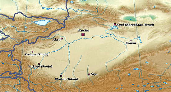 The largest of the 36 Tarim oasis statelets listed in the Hanshu [Book of Han]. Areas of the squares are proportional to population. Source:Wikimedia Commons original file: User Yugmodified by User:Kanguole - File:Emperor Taizong's campaign against Xiyu states.svg, CC 表示-継承 3.0, リンクによる 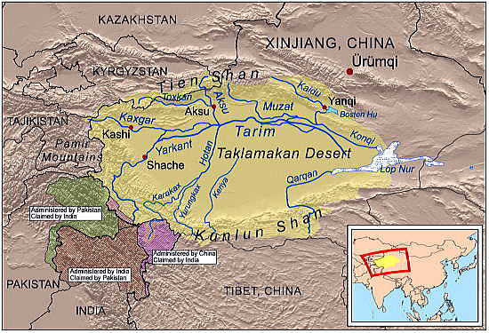 This is a map of the Tarim River drainage basin. Note that river courses shown crossing the Taklamakan Desert are usually dry. Sorce:Wikimedia Commons Kmusser - Own work using Digital Chart of the World and GTOPO data, labels based on GEOnet., CC 表示-継承 3.0, リンクによる 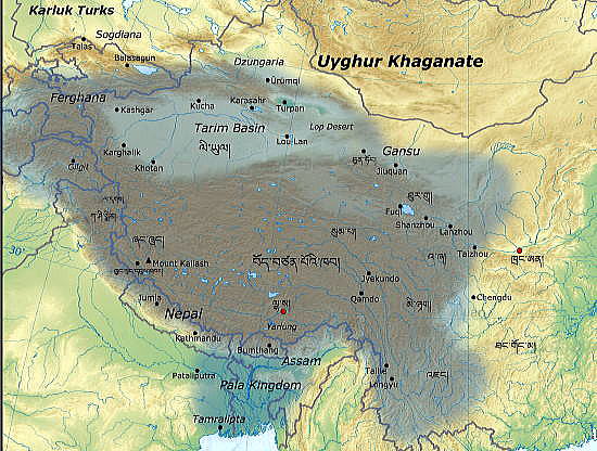 780s年代から 790s年代のタリム盆地 Sorce:Wikimedia Commons Phurbutsering - 投稿者自身による作品, CC 表示-継承 3.0, リンクによる 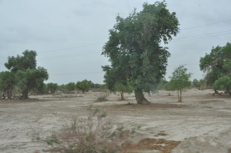 Tarim Desert Highway - Desert poplars (胡楊), Xinjiang, China Sorce:Wikimedia Commons Yoshi Canopus - 投稿者自身による作品, CC 表示-継承 4.0, リンクによる 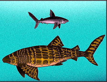 Comparison of the lamnid-like shark Archaeolamna apophysata, and the whale shark Eorhincodon tianshanensis, from the Late Eocene of the Tarim Basin, Inner Mongolia. Sorce:Wikimedia Commons Apokryltaros - 投稿者自身による作品, CC 表示-継承 4.0, リンクによる 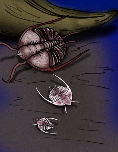 Comparison of the "taklamakaniid" raphiophorids Taklamakania tarimensis, and Pseudampyxina trisegmenta, from the Upper Ordovician Tarim Basin, Inner Mongolia Sorce:Wikimedia Commons Apokryltaros - 投稿者自身による作品, CC 表示-継承 4.0, リンクによる 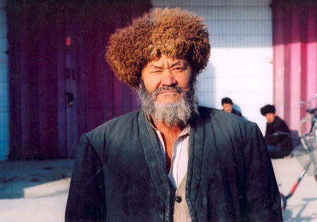 Uyghur hunter, Kashgar. Sorce:Wikimedia Commons https://www.flickr.com/photos/90987386@N05/ - https://www.flickr.com/photos/90987386@N05/8266396023/in/set-72157632234085940, CC 表示-継承 2.0, リンクによる 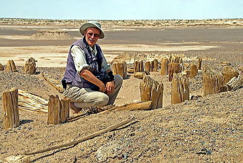 Christoph Baumer at Bronze Age graveyard Kawrigul (Gumugo) Sorce:Wikimedia Commons https://www.flickr.com/photos/90987386@N05/ - https://www.flickr.com/photos/90987386@N05/8266396023/in/set-72157632234085940, CC 表示-継承 2.0, リンクによる 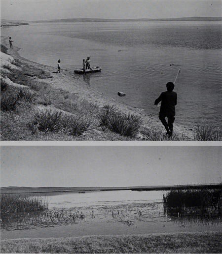 大英博物館紀要(自然史)動物学(1989-90) Title: Bulletin of the British Museum (Natural History) Zoology Identifier: bulletinofbritis5556farn (find matches) Year: 1989-90 (1980s) Authors: Farn, Alexander E Subjects: Publisher: London : Butterworths Contributing Library: Natural History Museum Library, London Digitizing Sponsor: Natural History Museum Library, London View Book Page: Book Viewer About This Book: Catalog Entry View All Images: All Images From Book Click here to view book online to see this illustration in context in a browseable online version of this book. Text Appearing Before Image: R. A. TRAVERS Text Appearing After Image: Fig. 5 Principal collecting locality Ugiy Nuur, 1 km west of outlet into Orkhon Gol. (Above) Beach seining along southern shore and (Below) swamp region prior to outlet into Orkhon Gol. and Tarim Gols: Fig. 3); 2) high altitude 'salmon rivers' (Odum, 1978: 298) with fast flowing, clear water over a stony, gravel substrate with little rooted aquatic vegetation (e.g. Orkhon and Terilg Gols: Fig. 4); and 3) narrow head-water streams that course across high altitude alpine meadows and consist of deeper pools and riffles (e.g. Hogshin Orkhon Gol: Fig. 2 locality 4). Generally they have grassy banks and wide flood plains, with small rivulets and ponds. The water level was often high, with increased current and flooding at several localities. This was due to the high precipitation during the months of July and August in northern parts of Mongolia (Petrov, 1970). The sparse vegetation allows rapid run-off which results in dramatic changes in water level following short but heavy periods of rainfall. Note About Images Please note that these images are extracted from scanned page images that may have been digitally enhanced for readability - coloration and appearance of these illustrations may not perfectly resemble the original work. Farn, Alexander E - https://www.flickr.com/photos/internetarchivebookimages/20259875438/Source book page: https://archive.org/stream/bulletinofbritis5556farn/#page/n191/mode/1up, No restrictions, リンクによる Sorce:Wikimedia Commons ロプノールへつづく 総合メニュー(西域) |